
How Far Is Everything in Croatia, Really? A Realistic Guide to Coastal & Island Travel by Sea
Croatia on the Map vs. Croatia in Real Life
What appears “close” on a flat map often stretches in real life because the Croatian coast is not a single line—it’s a lacework. Islands such as Hvar, Brač, and Korčula sit off the mainland like stepping stones, yet the nearest point-to-point line is rarely the one you actually travel. Sea travel is port-to-port, not point-to-point. Boats depart from specific piers, navigate around capes and islets, and call at islands that function as natural hubs.
Scale is another illusion. A short blue gap between Split and an island looks walkable with your eyes, but on the water it becomes a set of decisions: which port, which channel, whether the route includes an intermediate stop, and how the vessel fits into the broader network. The result is not “everything in an hour,” but a series of sensible segments that link coastal cities and islands the way locals actually move.
Coastal Cities: Distance vs. Travel Time by Sea
Between major coastal towns—Split, Zadar, Dubrovnik—water connections are designed to align the region’s geography with daily life. You might trace Split to Hvar with your finger and think “so close,” while Split to Dubrovnik looks further, yet your practical time depends on the route, the vessel type, and intermediate island calls.
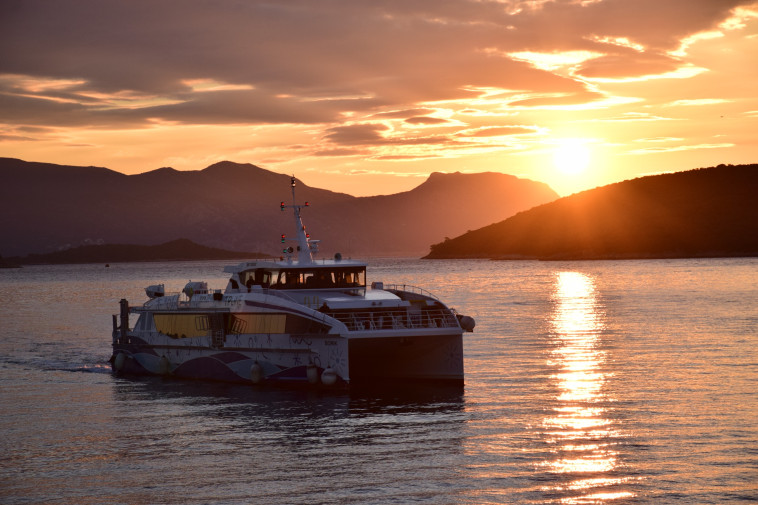
- Split to Hvar town typically feels like a short hop by catamaran, often measured in roughly an hour or a little more, depending on the exact port and stops. On routes like these, TP Line catamarans operate as part of a wider coastal network, linking ports that function as natural hubs for both locals and travelers.
- Dubrovnik to Korčula is farther on the map than Dubrovnik to Mljet across the same stretch of sea, but a direct call to Korčula’s port can be remarkably straightforward.
- Routes from Zadar toward nearby islands such as Dugi Otok follow sheltered channels that respect the coastline’s shape rather than cutting across every bay.
The key is to think in segments, not straight-line distance. A realistic plan accepts that coastal sailing connects communities in a sequence—and that sequence is what shapes your day.
Island Travel: Why Distance Works Differently by Sea
On islands, the “as-the-seagull-flies” line rarely applies. A cove may face the mainland, but the nearest safe entrance to the bay might be around a headland. A boat to Brač may call at one port on the island, while your accommodation sits in another bay entirely. Island time is practical time: boarding, disembarking, and crossing a channel efficiently, sometimes with a stop at a neighboring island that shares the same maritime corridor.
Expect routes to prioritize well-sheltered ports and central towns—Hvar town on Hvar, Korčula old town on Korčula, Sobra or Pomena on Mljet—because these are natural gathering points for travelers and locals alike. Small distance does not always equal short travel time, and that’s normal on the Adriatic. The reward is reliability: a network that moves with the coastline rather than against it.
Why the Sea Is the Most Natural Way to Travel Along the Croatian Coast
The Croatian coast was built from the water inward. Old towns face the sea, stone quays double as plazas, and the port is often the heart of the place. Sailing across the Adriatic Sea aligns with this heritage. Catamarans slip between islands without the detours that land routes must take around mountains and deep bays, and they connect exactly where life happens—by the harbor.
This mode of travel is also intuitive for itineraries that chain islands: Split to Brač to Hvar to Korčula, or Dubrovnik to Mljet to Lastovo, even up to Šipan in the Elaphiti. The sea respects the geography, and the network respects the sea, so movements feel natural: board at the port, step off in the old town, and keep your day focused on the coastline rather than on transfers that pull you away from it. Always check the current timetable to keep your travel plans on track. Secure your seat in advance through TP Line's online webshop for a hassle-free journey.
Tips for Planning a Realistic Coastal & Island Itinerary
- Choose a cluster, not a scatter. Pick one part of the Croatian coast—Central Dalmatia around Split, the Dubrovnik archipelago, or the Zadar island group—and let the network guide your sequence.
- Travel one direction when possible. Moving steadily along the coast or through an island chain reduces backtracking and makes each hour on the water count.
- Build around ports, not pins. Verify the actual port names in each town and on each island; ferries and catamarans use specific piers that might be in a different bay than your accommodation, information that’s easy to confirm via boarding places.
- Stay longer in fewer places. Two or three bases with day trips by boat feel calmer than five beds in five nights. Depth over distance is the Adriatic way.
- Leave buffer time. Sea conditions are usually favorable, but a modest cushion keeps connections comfortable and your day unrushed.
- Pack with boarding in mind. Rolling a light bag along a waterfront promenade is easier than hauling heavy luggage up steps near the port.
- Match the vibe to the route. Some islands suit a leisurely day with swims near a quiet beach or bay; others center on lively old town promenades. Plan sailing time so you arrive with daylight to enjoy the place.
Closing Thoughts: Embrace the Rhythm of the Adriatic
As you plan your journey along Croatia’s stunning coastline, let the Adriatic shape your adventure. Traveling by sea is more than just a means of transport—it’s a timeless experience that allows you to immerse yourself in the region’s beauty, history, and rhythm of life. By choosing smart routes that connect hubs like Hvar Island, Korčula Island, and others, you’ll discover the authentic charm that makes the Croatian coast truly magical. Checking the TP Line timetable helps translate this rhythm into a realistic plan—allowing you to experience Croatia the way it has always unfolded: by sea.